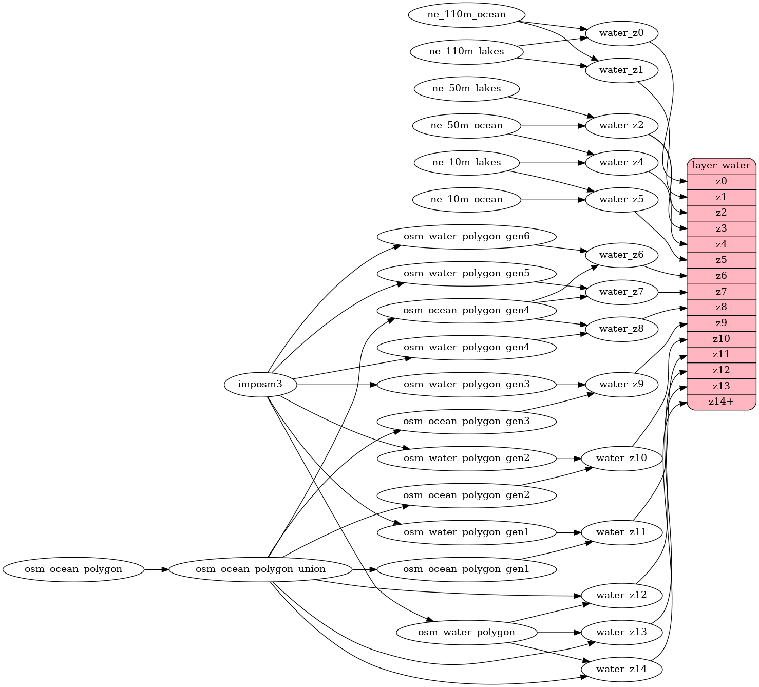
The ocean layer (table osm_ocean_polygon insert by `make import-data`) is made from squares that have a 10m buffer.

This creates extra geometry in vector tiles as:

Union of full ocean squares should decrease the size of the water layer.

there are 8042 polygons (squares, 5 points, more then 100km<sup>2</sup>), which was reduced to 22 polygons - 1184kB vs 40kB respectively.

In mbtiles should be the size reduction even more significant, due to the creation of more polygons based on a 10m buffer of each square.
water
Docs
Read the layer documentation at http://openmaptiles.org/schema#water
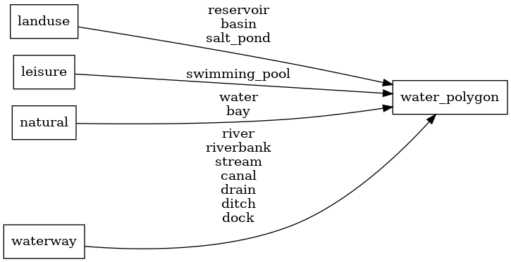
Mapping Diagram
ETL diagram