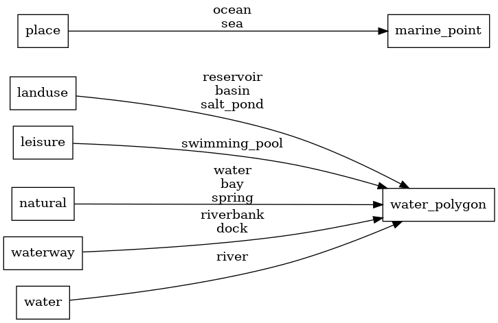
This PR is a bugfix for the `water` layer. * `waterway=stream`, `waterway=river`, `waterway=canal`, `waterway=ditch`, and `waterway=drain` are all linear features, not area features. Thus, these objects are being unnecessarily mapped into the `osm_water_polygon` polygon table, and this PR removes these unneeded mappings. * The combination `natural=water` + `water=river` is the most popular tagging for river areas. However, the current mapping causes rivers tagged in this way to be rendered in the vector tiles as a `lake`. This PR adds a check for the `water=river` tag and tags both variants of river areas as `class=river`. `natural=water` + `water=river` river mapping:  `waterway=riverbank` river mapping:  Lake mapping for a `natural=water` (with no other tagging): 
water_name
Docs
Read the layer documentation at http://openmaptiles.org/schema#water_name
Mapping Diagram
ETL diagram
