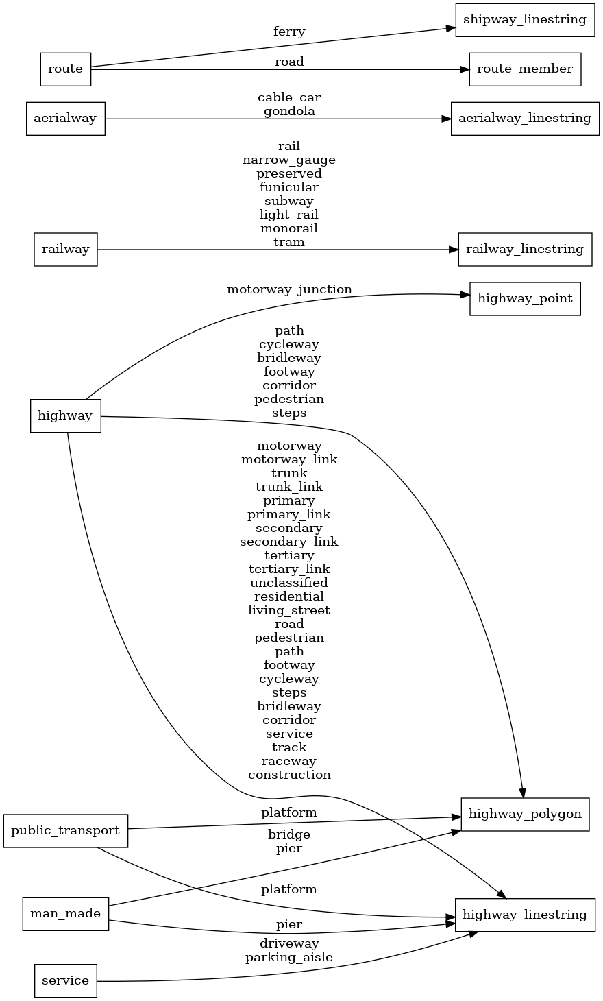
Fixes #1191

This PR suppresses `highway=service` at zoom 12, where it is not a useful level of detail.  This makes OpenMapTiles consistent with openstreetmap-carto, which does not begin showing `highway=service` until raster zoom 14 / vector zoom 13.

Additionally, this PR suppresses `highway=service` + `service=parking_aisle` / `service=driveway` from zooms 12-13, as this detail is excessive below zoom 14.  As a point of comparison, openstreetmap-carto does not begin showing `service=parking_aisle` / `service=driveway` until raster zoom 16 (vector zoom 15).
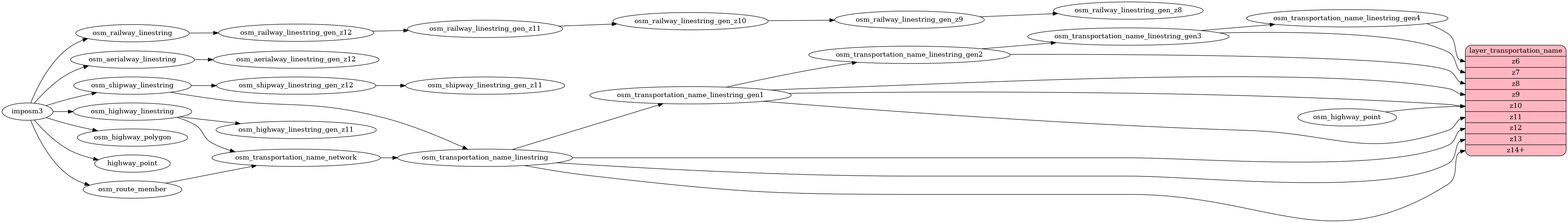
transportation_name
Docs
Read the layer documentation at http://openmaptiles.org/schema#transportation_name
Mapping Diagram
ETL diagram