This adds support to show the Trans-Canada Highway at zoom 4.  Despite being the most important highway network in Canada, portions are `highway=trunk` due to the remoteness of the countryside.  However, it's still important to show a connected highway network at the lowest zoom without showing all trunk roads at this zoom.

This change also adds support for US Interstate Highways to be drawn at z4 when they're tagged as trunks.  There's only a few examples of this, but it removes those (tiny) gaps from the generalized road geometries. As we identify additional countries which should have their most important road network rendered at the lowest road zoom even if they're trunk, we can add them to the list of networks that get this treatment.
transportation
Docs
Read the layer documentation at http://openmaptiles.org/schema#transportation
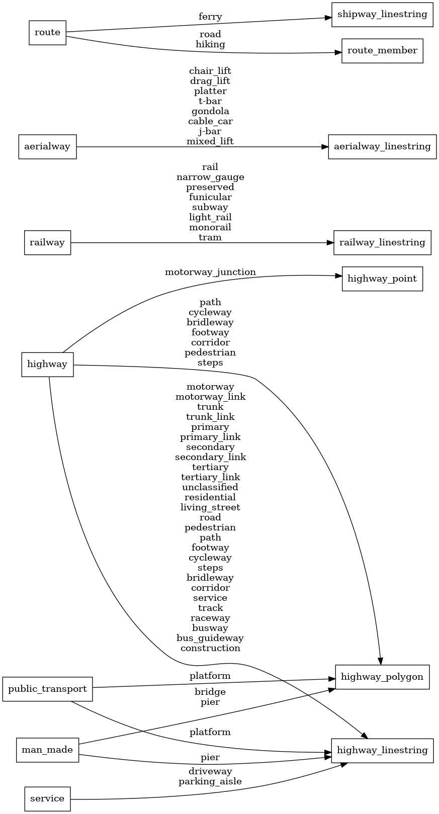
Mapping Diagram
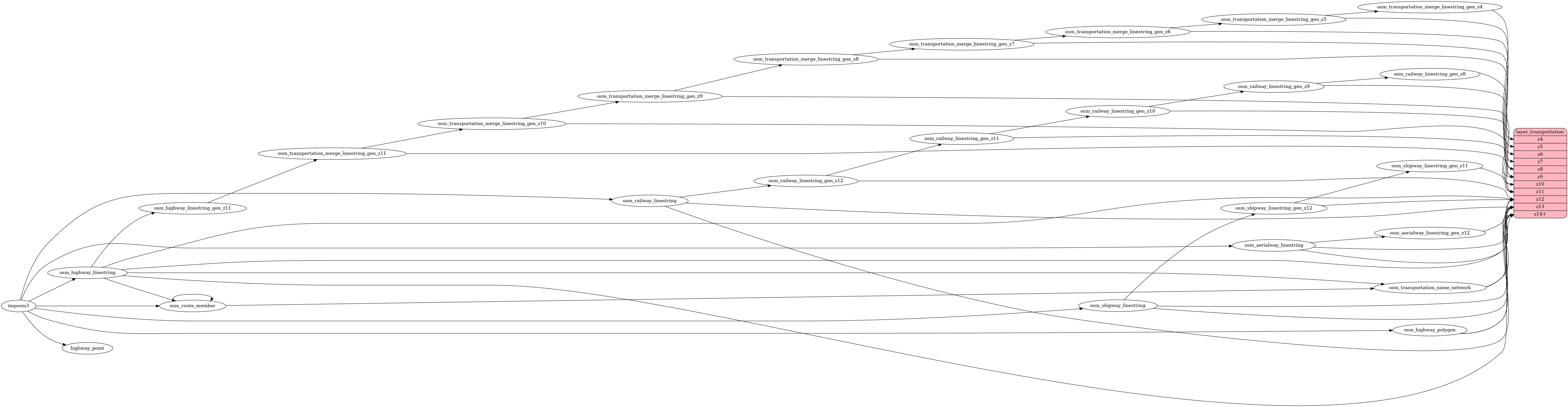
ETL diagram