This PR follows #1465 to implement pseudo-route relations for Republic of Ireland road routes as described in the [OSM wiki](https://wiki.openstreetmap.org/wiki/Ireland/Roads). Irish road routes work in the same way as UK road routes in that signage is derived from highway classification on a 1:1 basis. The scheme described in the OSM wiki is confirmed via [overpass query](https://overpass-turbo.eu/s/1por).

This feature follows the implementation currently used for UK road routes, in which a 10m Natural Earth polygon is used to determine which roads are located within Ireland to apply this processing.

This PR implements 3 classes of routes:
* M-roads, which are `highway=motorway` and signed with blue/white lettering.
* N-roads ("national roads"), which are `highway=trunk` or `highway=primary` and are signed with green/yellow lettering.
* R- and L-roads ("regional and local roads"), which are `highway=secondary`, `highway=tertiary` or `highway=unclassified`, and signed with white/black lettering
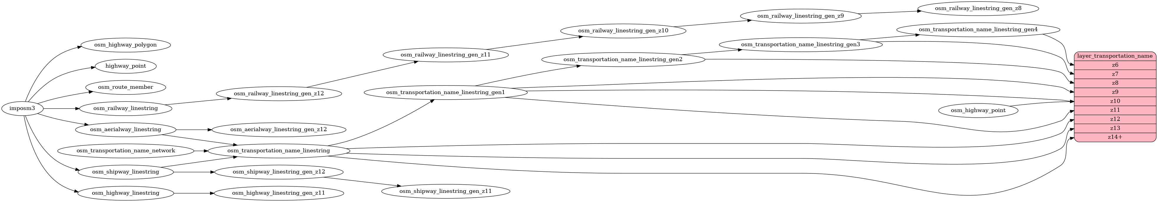
transportation_name
Docs
Read the layer documentation at http://openmaptiles.org/schema#transportation_name
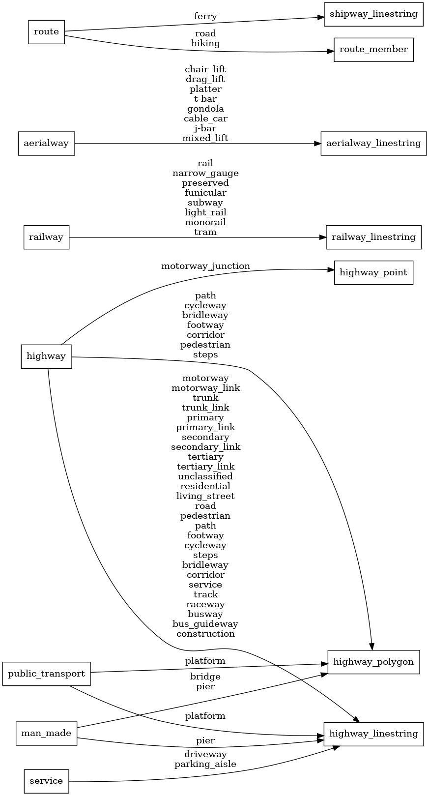
Mapping Diagram
ETL diagram